

2022 Trips


Tamanawas Falls
4.5 miles of hiking • 500' elevation gain •
I never get tired of seeing the lacy ice that gets formed along the creek.

December 19, 2022

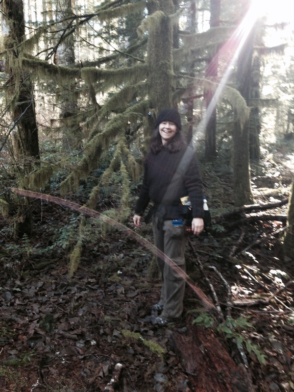
Tilly Jane hike
3.5 miles of hiking • 1500' elevation gain •
Did a few miles up the Tilly Jane trail. The snow was easy to walk on until we hit the ridge about 1.5 miles up.
November 9, 2022

Multnomah Wahkeena Loop
5 miles of hiking • 1500' elevation gain •
I haven't hiked as much this summer. But the gorge is still beautiful.
October 7, 2022

Indian Heaven
11.7 miles of hiking • 1500' elevation gain •
Great hike up to Deep Lake. The huckleberry foliage is beautiful right now.
September 24, 2022
 1
1
Canyon Creek Meadows Three Finger Jack
8 miles of hiking • 1500' elevation gain •
The flowers are mostly gone in the meadows but we climbed up to the tarn and then scrambled up to the saddle and wandered around. Wonderful last day of August!
August 29, 2022
 1
1
Above Timberline still covid recovering
4 miles of hiking • 1750' elevation gain •
I wanted to try and get my altitude legs back so I drove with a friend and did a short but steep hike up above and a bit east Timberline Lodge. The bloom is mostly done, but the views were great of the area and down into White Rive Canyon.
August 25, 2022
 1
1
Timberline from meadows to Heather Canyon.
8 miles of hiking • 1000' elevation gain •
Did a lovely Covid recovery hike up to Heather Canyon and then bushwhacked a little ways up the creek. All the creeks are still really high on the mountain right now. And a ton of people today but wonderful
August 13, 2022
 2
2
Herman Creek
15.4 miles of hiking • 3000' elevation gain •
Great day hiking up the Herman Creek Trail through Cedar Swamp to the East Fork Crossing.
July 18, 2022
 1
1
Silver Star and a bit more
8.5 miles of hiking • 2000' elevation gain •
The bloom is on! I hiked up from Grouse Vista to the top, then came down and walked the ridge line north paralleling Ed's Trail to see the bloom out there. Beautiful!! Dead calm, so the bugs were out but not too bad. Excellent day with a great crew.
July 12, 2022
 1
1
PCT Benson Plateau
9.4 miles of hiking • 3000' elevation gain •
Early morning outing to the red rock viewpoint up the PCT on the way to Benson Plateau. Marvelous
July 1, 2022
 1
1
Oneonta Franklin Ridge Loop
13.4 miles of hiking • 3250' elevation gain •
Beautiful day but definitely an adventure. We parked at Multnomah Falls. 400 trail over to Oneonta. Amazing views of the upper gorge. Up to Franklin Ridge. Once we got into the burn on Franklin Ridge it was crazy amounts of six foot plus brush covering the trail. Once you start descending from the ridge it started clearing up. Then we took the Larch Mountain Trail back to our cars. Beautiful day!!!
June 29, 2022
 1
1
Salmon Butte
12.2 miles of hiking • 3500' elevation gain •
Fantastic five peak day. No snow on the trail except one small patch. The rhodies were blooming further down but the big rhodie alley is a few weeks away from bloom. Saw a geo cache up there for the first time and signed the summit register. Beautiful clear day!!!
June 25, 2022
 1
1
Angels Rest Area
6.4 miles of hiking • 1500' elevation gain •
Happy Solstice Hikers! Great day taking a quick hike up in the Angels Rest area.
June 21, 2022
 1
1
Falls Creek Falls
6.1 miles of hiking • 1250' elevation gain •
Had a lovely easy day hiking out to the falls. Super full and beautiful.
June 12, 2022
 1
1
Surveyors Ridge
18 miles of hiking • 1250' elevation gain •
Did the south end of Surveyors, which is always quieter. The blooms are just getting started. A couple of weeks, I think, if the weather stays cool. We started at the Clinger Springs area, where the trail comes next to Rd 44. We generally headed north, scrambling up a few small peaks on the way and going past Shellrock mountain. There are mountain bikers out there, but not as many on the south end.
June 9, 2022
 1
1
Memaloose and Mosier Plateau
6.8 miles of hiking • 1250' elevation gain •
Beautiful day amongst the wildflowers. Two easy hikes and ice cream to finish
May 23, 2022
 1
1
Phlox Point
8.5 miles of hiking • 2000' elevation gain •
No snow, beautiful views, and Glacier Lilies. Tanner Butte was looking amazing in the distance. Wonderful day!
May 22, 2022
 1
1
Catherine Creek Uppper Tracy Hill
10 miles of hiking • 1750' elevation gain •
Did a lesser know area of Catherine Creek up at the top of Tracy Hill to an old Adirondack two-seater in a meadow. The lupine on the east side and higher up still hasn't bloomed. but al the mini flowers are at peak. Fantastic day and good company.
May 8, 2022
 1
1
Tilikum Bridge Loop Urban Hike
8.4 miles of hiking • 0' elevation gain •
I walked from my house to join Keri Sprenger to do an urban loop while her wife got some dentistry done. We saw a goose tending an egg, multiple dragon boats, and lots of Portlanders worshipping the sun. Awesome afternoon.
May 4, 2022
 1
1
Seven Mile Hill McCall Point Loop
8 miles of hiking • 1750' elevation gain •
New route for me with a little offtrail. Balsam root still is going strong and will be for a while. Lupine is just starting. Great hike.
April 23, 2022
 1
1
Dalles Mt Ranch
8 miles of hiking • 1000' elevation gain •
I'd say the bloom is at peak below the ranch. Both Lupine and Balsam going well with some Phlox blooming. Super crowded which was to be expected, but lovely.
April 23, 2022
 1
1
Rowena McCall
6 miles of hiking • 1250' elevation gain •
Flowers are just starting and it wasn't too crowded.
April 17, 2022
 1
1
Forest Park Gymnastics Hike.
4 miles of hiking • 500' elevation gain •
A slow pace and a tight schedule made for a short hike. We started at Newberry Road, heading east along the Wildwood. The powerline was draped over the parking area. Tons of trees were down, but only a few required a roundabout off-trail. But it was pretty thick. Super nice. Trilliums and Violets were blooming, and other blooms were starting to pop. Lovely day!
April 15, 2022
 1
1
Hamilton Phlox Loop
14.8 miles of hiking • 4000' elevation gain •
Super fun loop. We headed north from the Hamilton Saddle and continued up out of the park on a brushy abandoned road. We hit a gravel road and took it west until it looped south and when we were directly below Phlox Point on the east side did a short 250' off trail to the top. Steep and super brushy but very short. Fat fluffy snowflakes were blowing all around and the avalanche lilies were starting to bloom. We headed down and took one more off-trail from the Equestrian back over to the Hamilton area and headed home after a very satisfying day.
April 10, 2022
 1
1
Urban Mt Tabor Hike
9 miles of hiking • 500' elevation gain •
I don't often add my urban hikes, but I figure if I have to avoid the poison oak along the side of the trail it's a real hike. Haha.
April 7, 2022
 1
1
Nick Eaton Deadwood Gorton Creek Trail
10 miles of hiking • 3250' elevation gain •
Had a great day up Herman Creek. We took Nick Eaton Way Trail up to the ridgeline and headed south. to about a half-mile past the Deadwood Trail. We decided to go down that way. Nick Eaton was a bit brushy past PK 3152 but not much blowdown. There is no longer a sign at the junction with the Deadwood trail and it's faint, snowed over, and has blowdown covering the trail in a few places. Navigation is required until you get about halfway down to Gorton Creek. Gray's Creek which is near Deadwood camp was actually flowing. Not much snow but some covering down logs at times, but it was fine. A fantastic day!
March 24, 2022
 1
1
Gumjuwac Saddle
7 miles of hiking • 2000' elevation gain •
My first snow trip up there. There were no tracks, and the trail was often unapparent. There were huge sections of no snow lower down, but pretty quickly, we needed spikes, and it was still challenging and hard to kick steps in, in some places. Navigation is definitely required, and even with a track, the trail was often not a good route. But the sun was out all day. The snow got deep and postholey near the saddle. The Gumjuwac sign was almost buried in snow. We wandered around a bit and headed back down. It was a fantastic day.
March 22, 2022
 1
1
Tracey Hill to Secret Adirondack Chairs
8.5 miles of hiking • 2000' elevation gain •
Fabulous day! We hiked up Tracy Hill, headed west, and then headed up the old road that heads to the public land boundary. Just barely in public land there is a meadow with a set of double adirondack chairs with a view of Hood. Awesome day, great company.
March 6, 2022
 1
1
February 27, 2022
 1
1
Forest Park snow dusted hike
7.5 miles of hiking • 500' elevation gain •
Just a dusting of snow on the trail and here and there in the woods. Awesome pre weekend hike/stroll.
February 25, 2022
 1
1
Birthday Hike Herman Creek to Cedar Swamp
14.8 miles of hiking • 2750' elevation gain •
With snow being super scarce I made it up to Cedar Swamp. People have been chipping away at the blowdown past Casey camp. So beautiful. Such a fun day.
February 19, 2022
 1
1
Tarbell Trail to Hidden Falls
11 miles of hiking • 1500' elevation gain •
Great day. They are doing constructuion near Hidden Falls on the weekdays and have a closed sign just before the falls, but no workers on Saturday!
January 29, 2022
 1
1
Dry Creek Falls Loop
5.6 miles of hiking • 750' elevation gain •
Great day. Some icy spots and spikes were helpful for the way down. But most people didn't have them and were fine.
January 16, 2022
 1
1
Hamilton Area Meander
11 miles of hiking • 1750' elevation gain •
We set out thinking Phlox Point if snow allowed. The road that goes off of Kueffler to the equestrian TH is closed. So we went over to Hamilton with the thought of seeing if we could get up Phlox that way. No snow until we were on the Equestrian Trail. We hit a place where snowshoes would have been helpful, although they would have also been challenging since there was a lot of down branches. After awhile we realized it was doable but not fun, so we went further up the creek instead of up to the ridge and crossed the upper bridge. I was sinking in snow above the knees, but it was still a great day.
January 15, 2022
 1
1
North Bonneville to past Greenleaf Creek
8 miles of hiking • 1250' elevation gain •
Bluebird day in the snow. So lovely along the PCT. Slushy and icy. Spikes might be helpful the next day or two.
January 9, 2022

View trips from: 2014 2015 2016 2017 2018 2019 2020 2021 2023