

53 miles of hiking • 11000' elevation gain • 4 nights
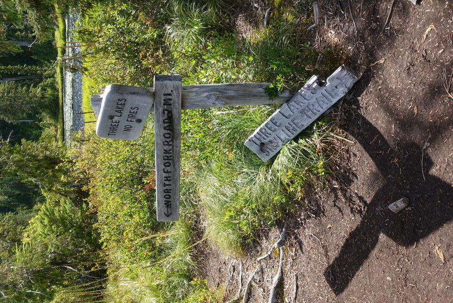
North Fork Quinault Trailhead (Parked at Irely Lakes Trailhead and road walked to the trailhead)
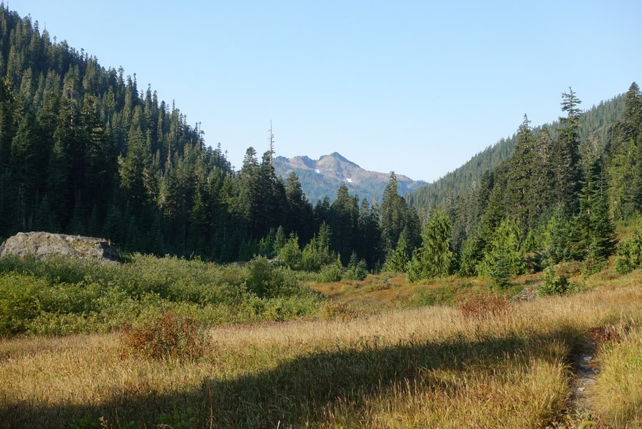
Day 1 - North Fork Quinault to Trapper Shelter - 9.74 miles, +1,428 ft, -716 ft
Day 2 - Trapper Shelter to Low Divide - 10.34 miles, +2,775 ft, -429 ft
Day 3 - Low Divide to Lake Beauty - 8.37 miles, +2,607 ft, -1,469 ft
Day 4 - Lake Beauty to Meadow past Kimta Peak - 8.75 miles, +2,793 ft gain, -2,734 ft
Day 5 - Meadow to Ireley Lake Trailhead - 16.23 miles, +1,157 ft, -5,399 ft
Total mileage: 53.43, Total gain: 10,760 ft
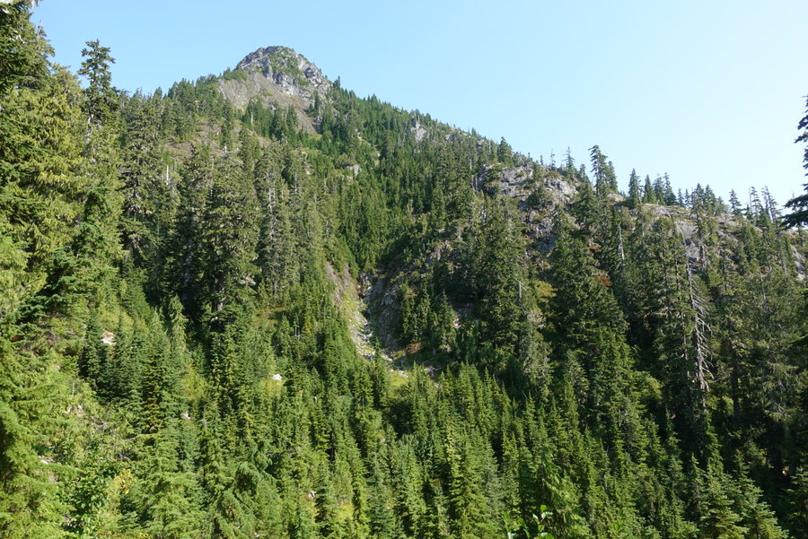
Day 1. North Fork Quinault to Trapper Shelter -
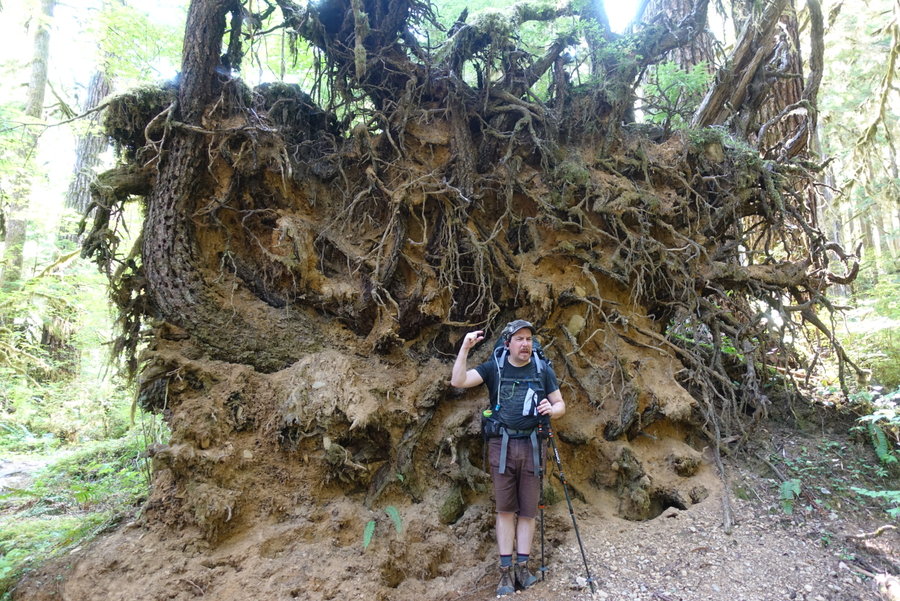
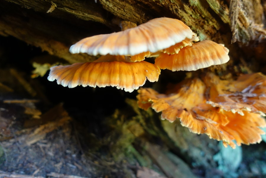
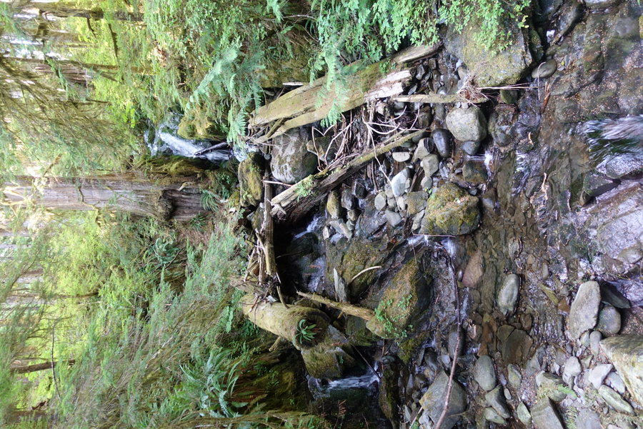
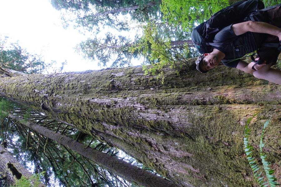
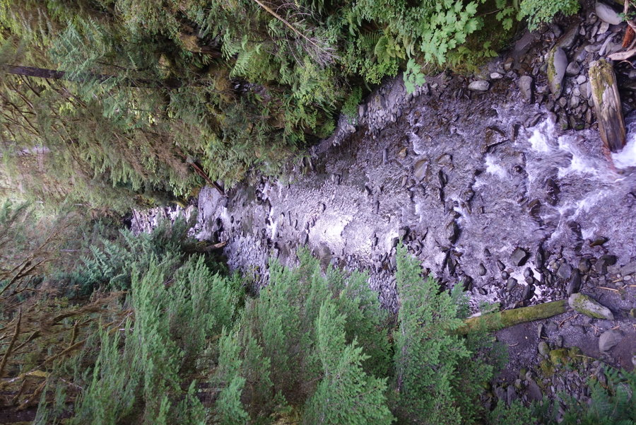
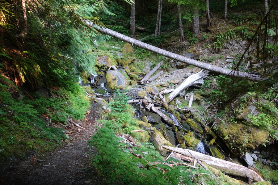
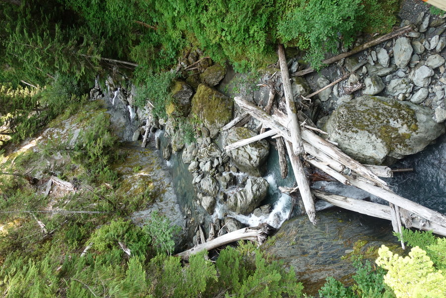
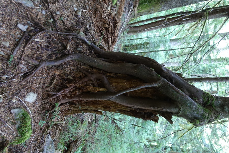
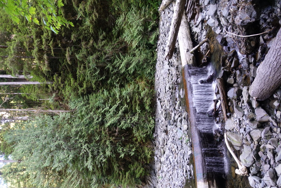
Parked at Irely Lake Trailhead, and walked the road past the ranger station to the North Fork Trailhead. Trail is in good shape. No blowdown, beautiful old growth, lots of chicken of the woods. Gain was nice and gradual, only difficulty was the humidity and heat, since we started in the afternoon after driving from Portland. We opted to sleep in the one camp spot behind the Trapper shelter, rather than stay in the shelter itself. If I were to do it over, I would either camp at Elip (much nicer spot with rushing water) or start earlier and go all the way to 16 mile camp. River ford at Elip was a rock hop and no problem at all. My only complaints: The SILENCE. The duff in the surrounding area made for a very very quiet camp, and I found it extremely hard to fall asleep even though I was exhausted. There is a privy here, but no bear wire and no suitable trees to hang. I couldn’t fit all of my food in my bear can, so we had to bring the rest in the tent with us. (Not ideal, but better than risking half of our food being stolen on Day 1.)
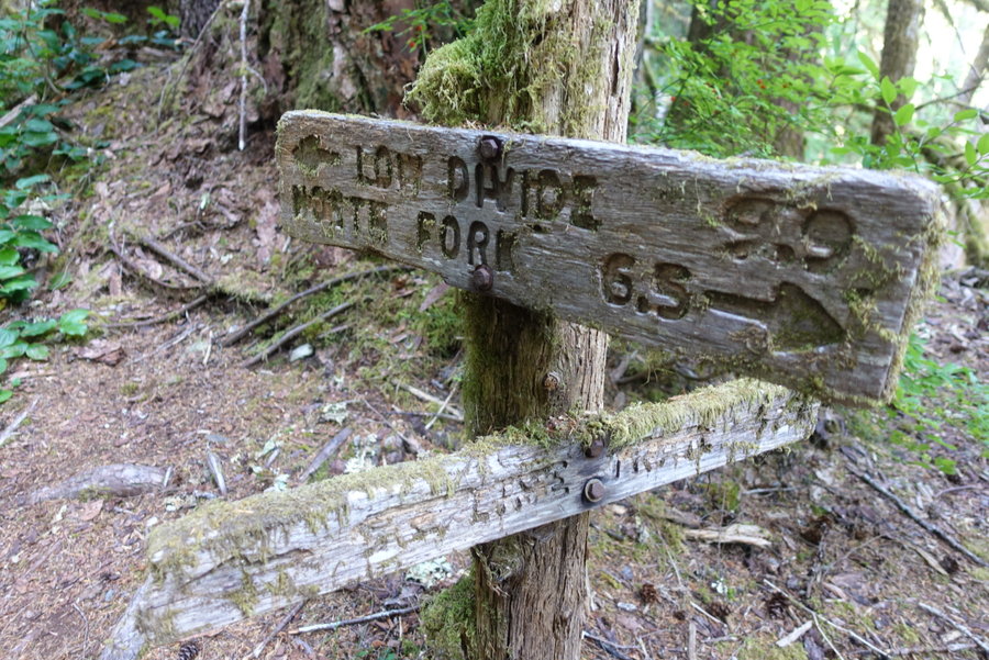
Day 2. Trapper Shelter to Low Divide
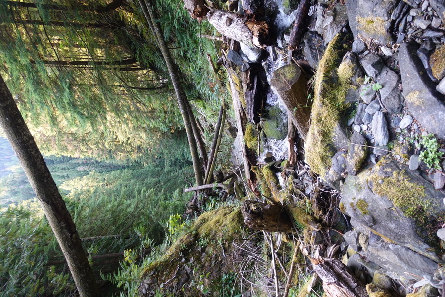
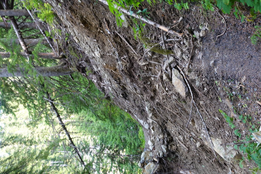
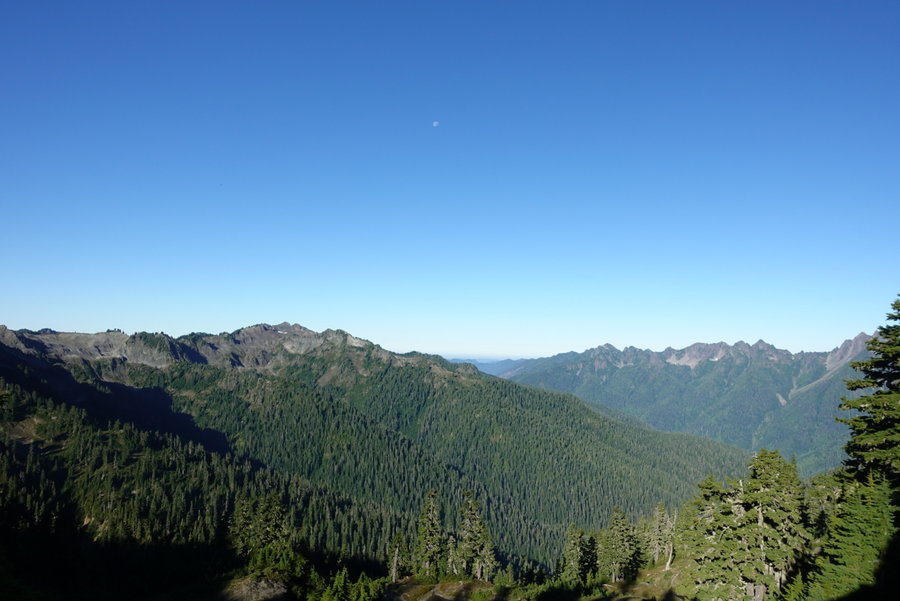
Quiet start to a relatively stress free day. Heat was still an issue, but not unbearable. Trail in good shape for the most part, easy ford at 16 mile camp. 16 mile had a really nice camp spot, with what looked like a brand new enclosure for the privy. Stay here rather than Trapper or Elip, if you can push far your first night. Ran into a couple that warned us of aggressive bees/hornets on the trail, but we didn’t run into any problems. One slide area that could use some work past 16 mile, but easily passable. Though our mileage wasn’t terrible, it was still a long day even with relatively gradual ascent. The huckleberries really started to take over here, and we stuffed our faces periodically as we hiked. We rolled into Low Divide in the afternoon, and I hung my hammock for a nice afternoon rest. We thought we might get company at Low Divide since it is also a stopping point for those doing a thru hike from/to the Elwha, but it was a solitary night other than two rangers (or possibly biologists?) who were stationed out there. We briefly spoke to a solo male hiker heading the opposite direction who was supposed to stop there, but he chose to push on to 16 mile. He warned us of the difficulty of the trail between Beauty and Kimta, and told us he had spotted 9 bears that day. He said most bears were higher up, where the huckleberry bushes were shorter and they could act as lawnmowers across the landscape sucking up berries. Once again, a quiet camp, and I tossed and turned into the night with very little solid sleep. Bear Wire here.
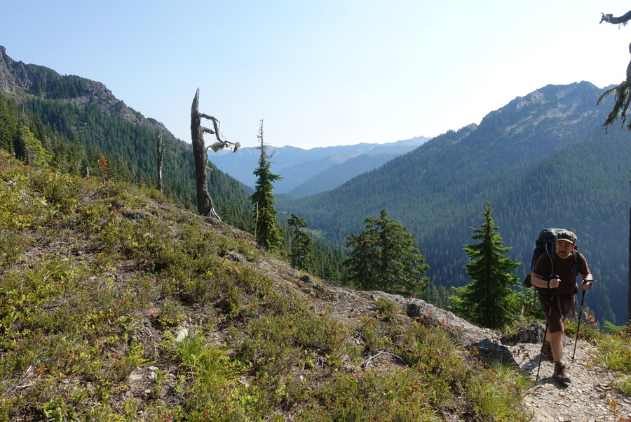
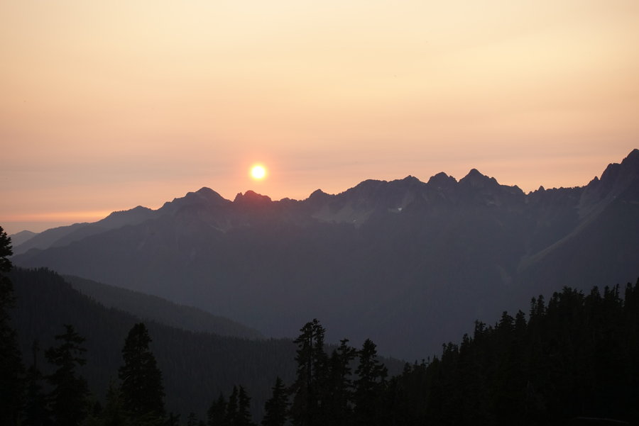
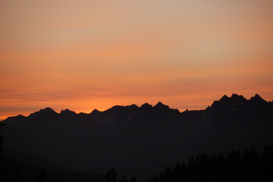
Day 3. Low Divide to Lake Beauty
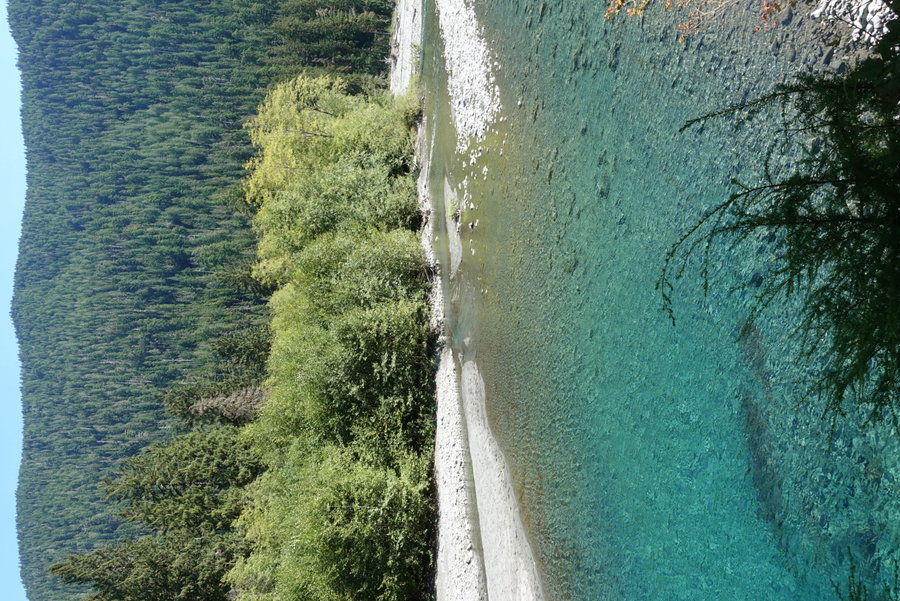
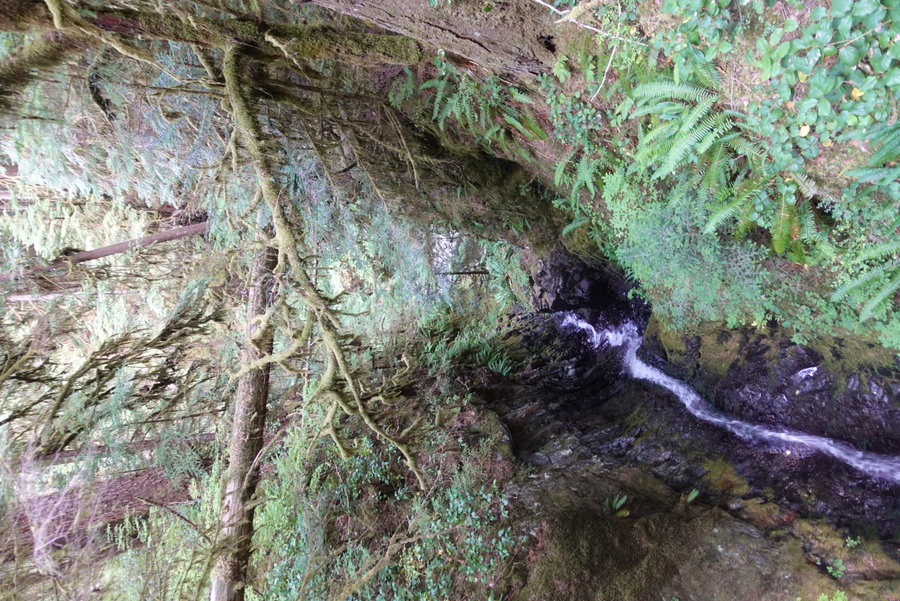
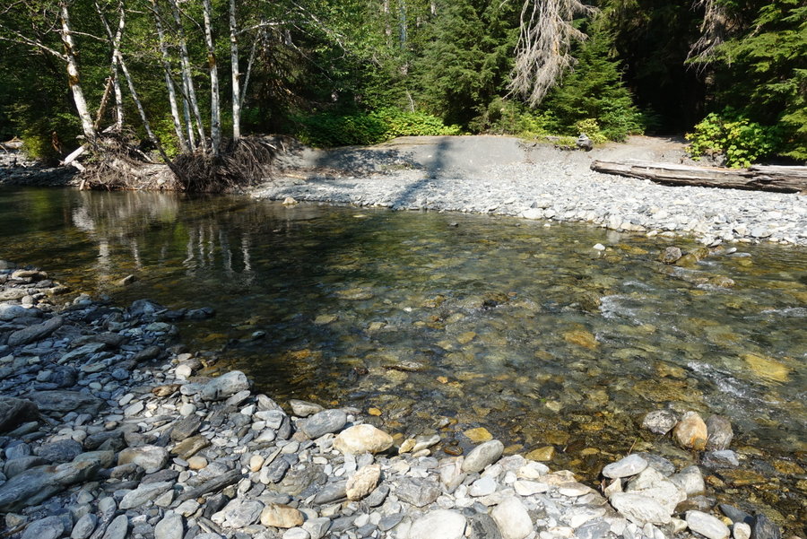
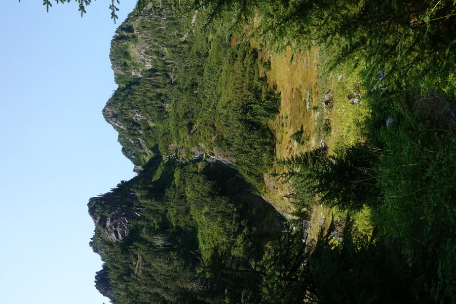
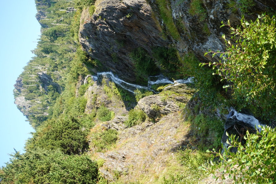
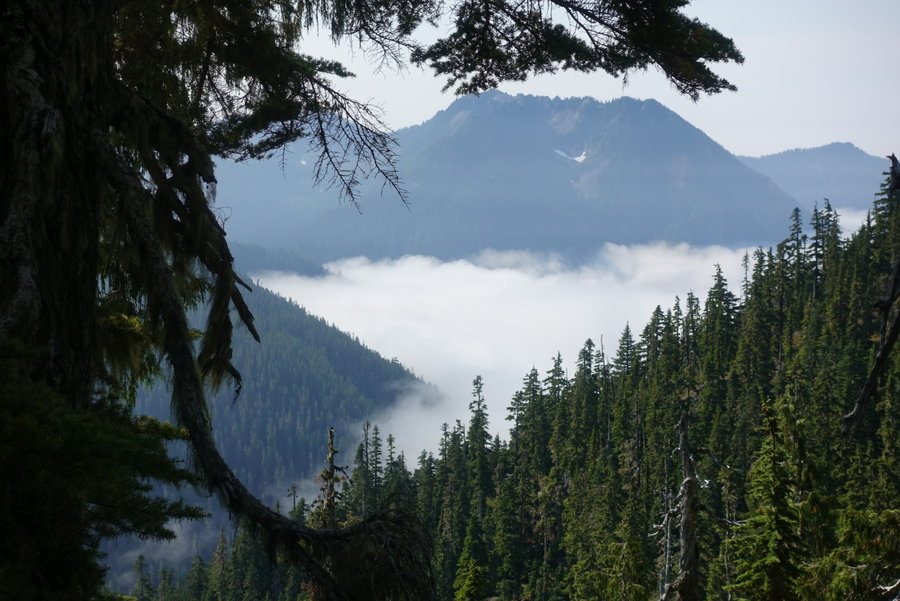
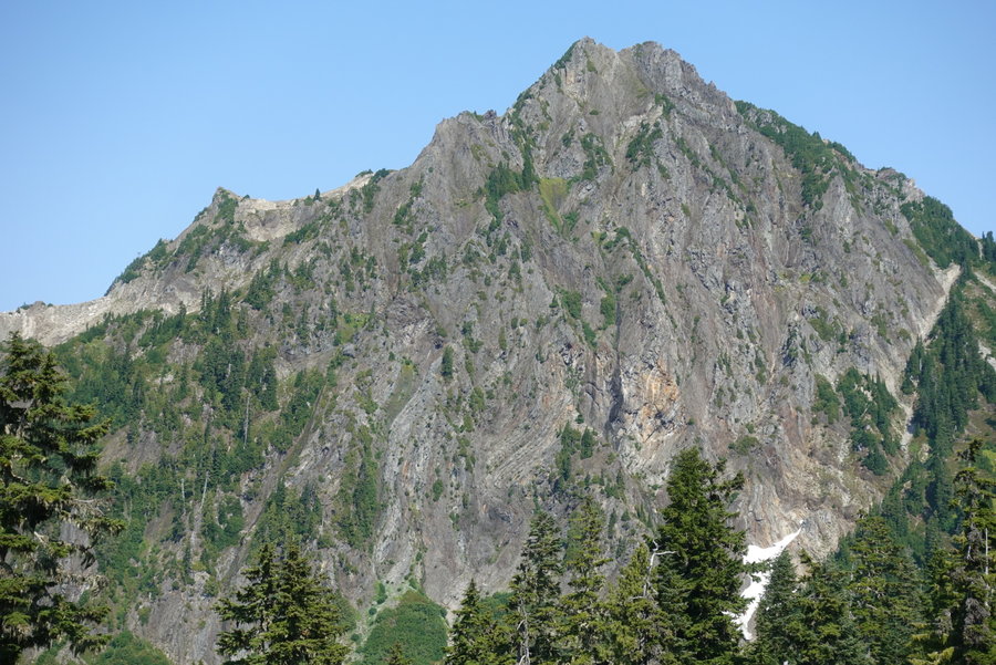
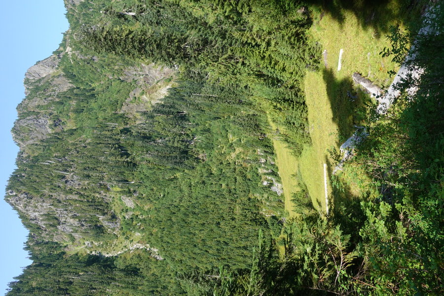
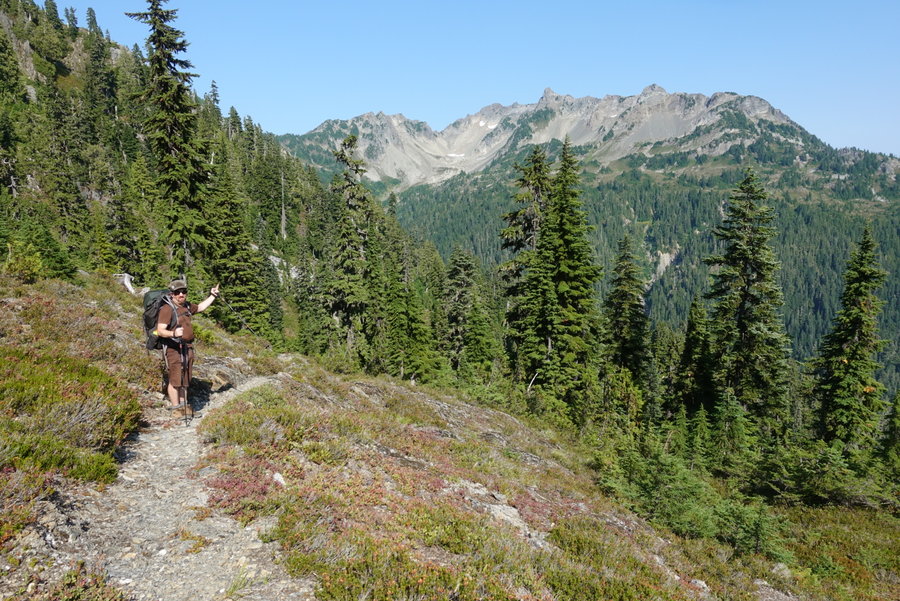
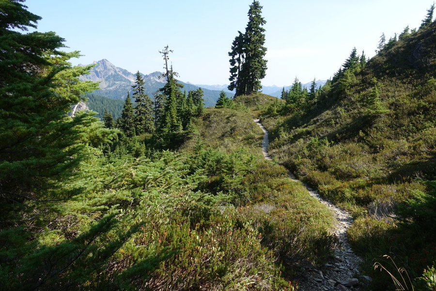
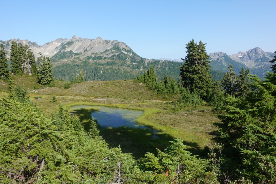
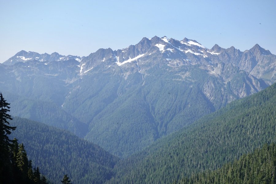
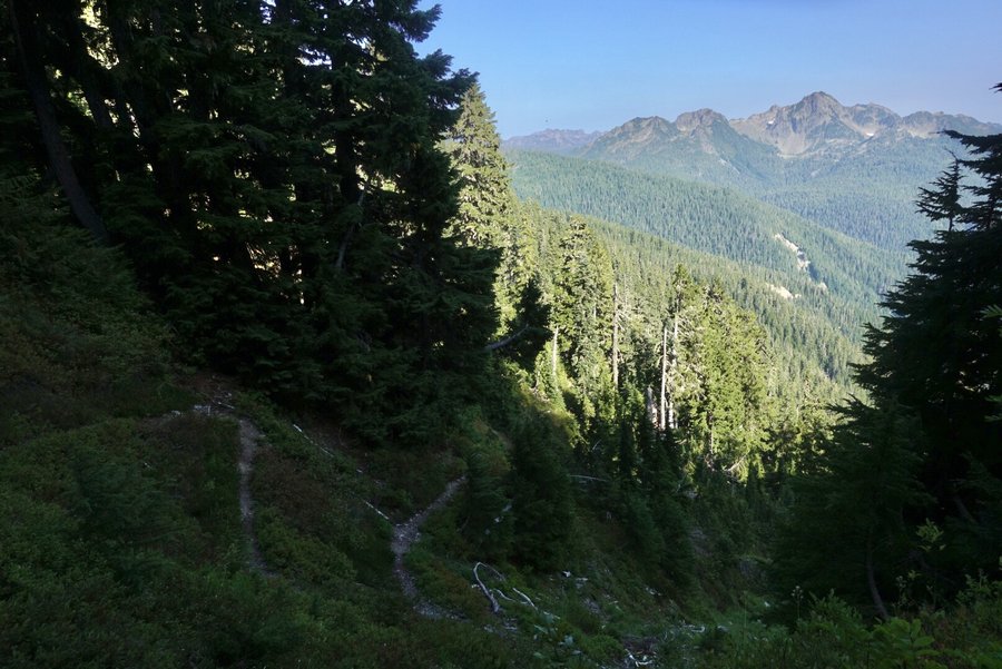
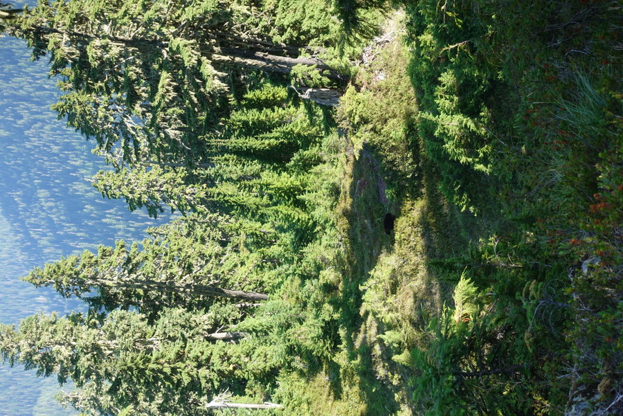
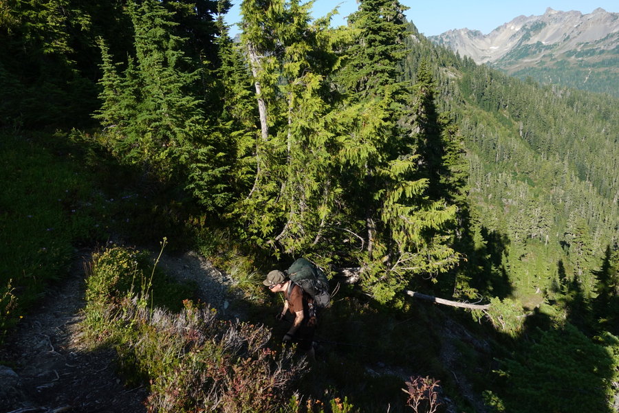
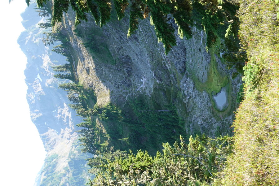
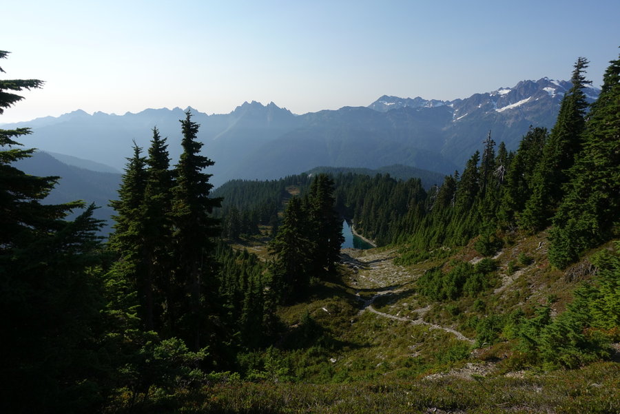
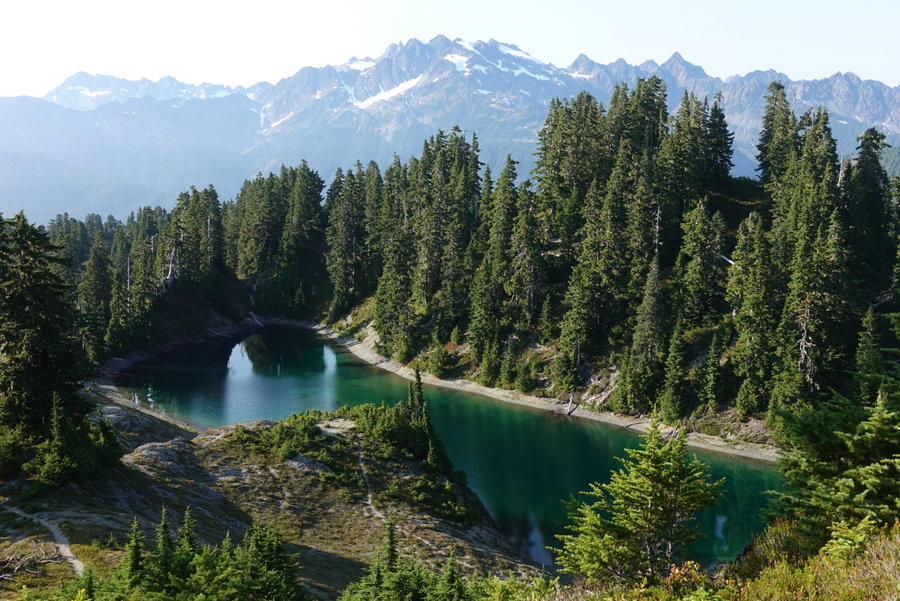
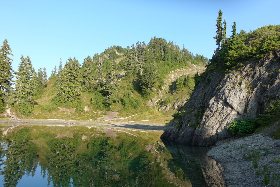
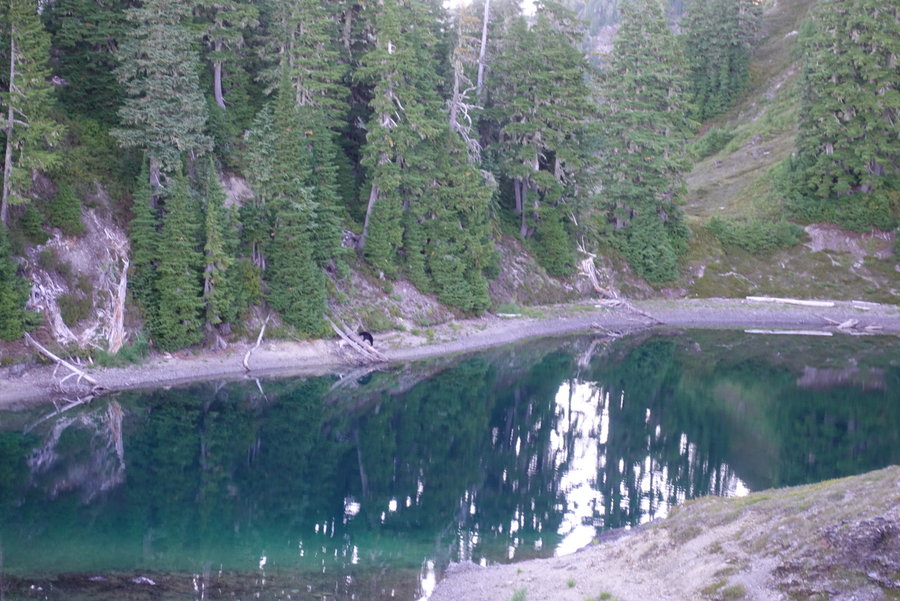
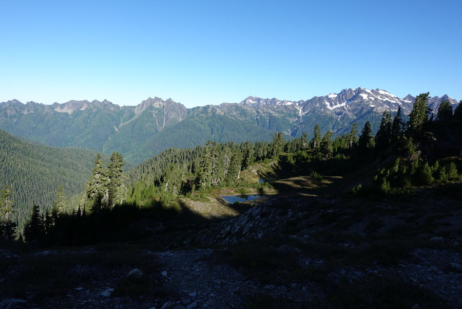
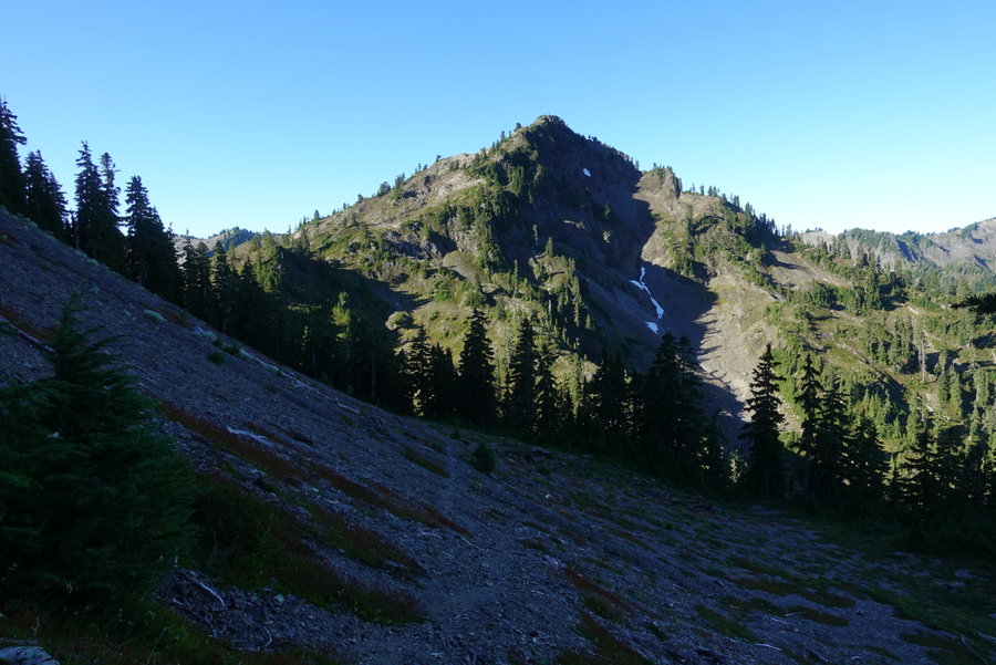
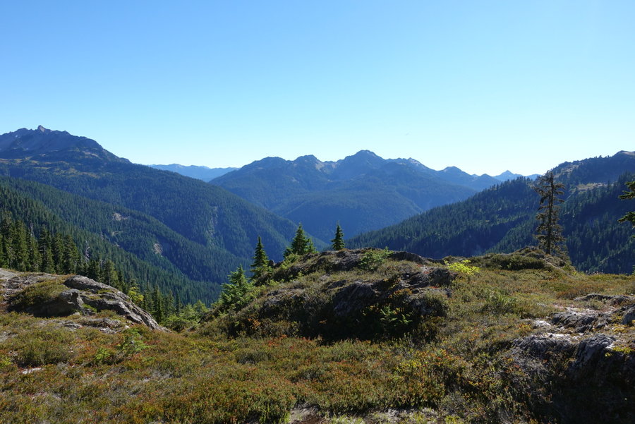
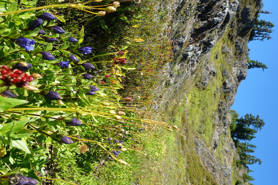
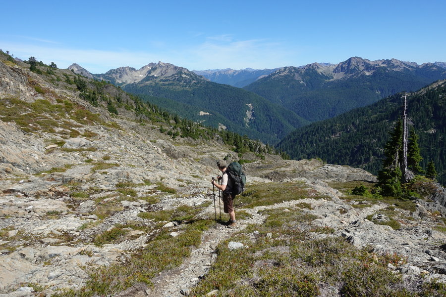
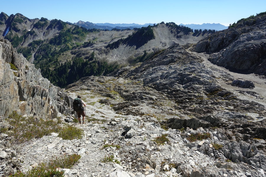
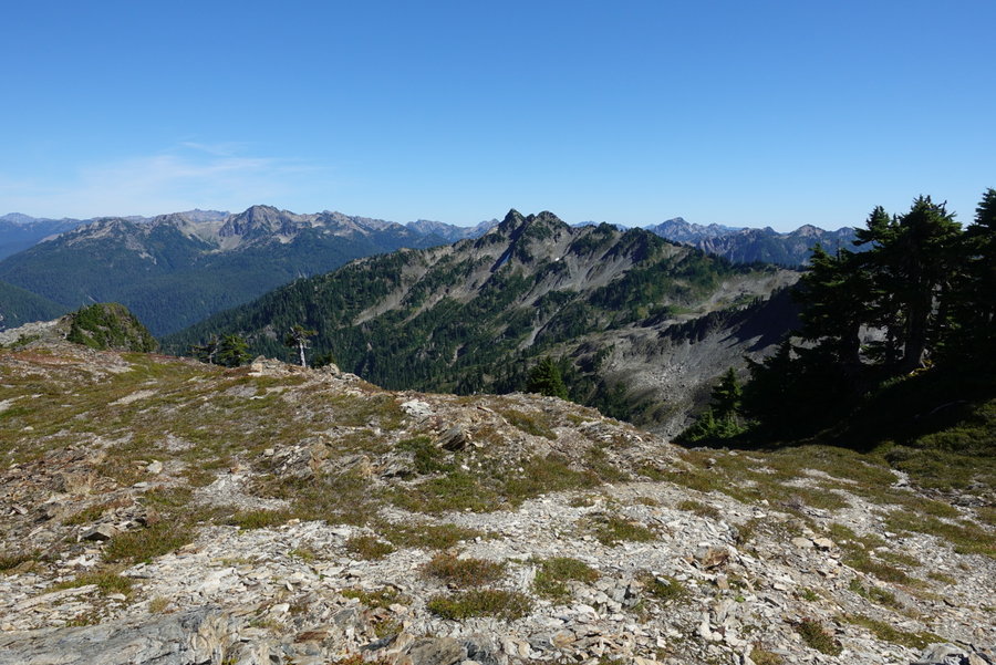
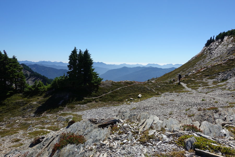
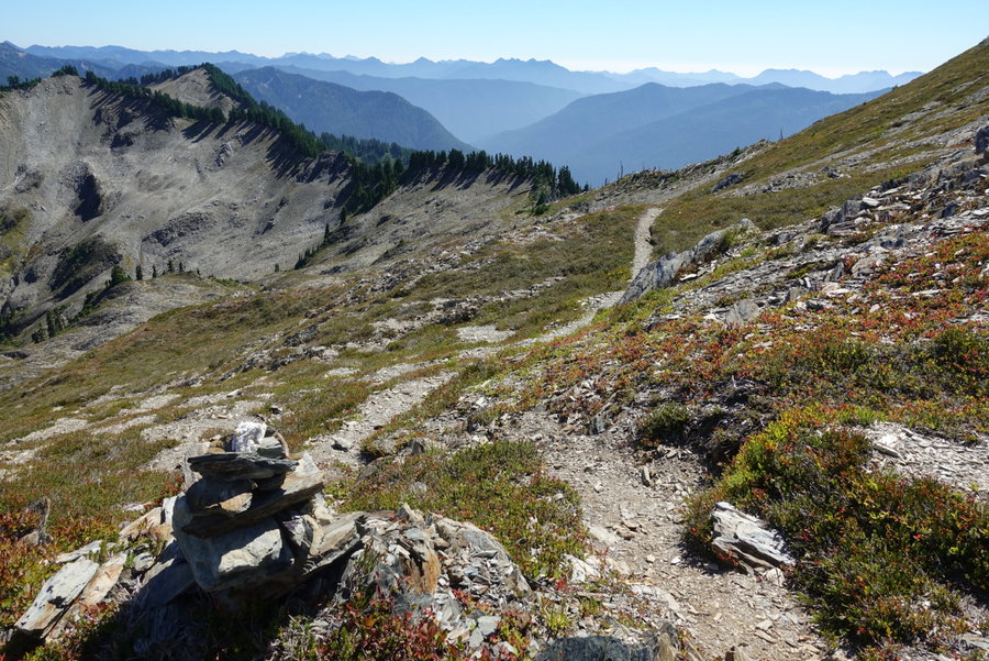
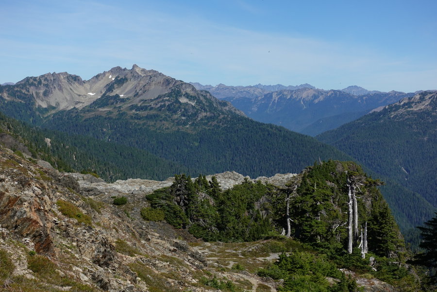
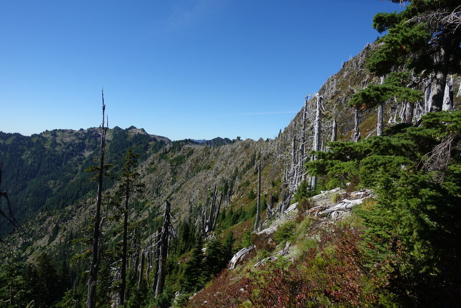
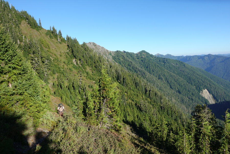
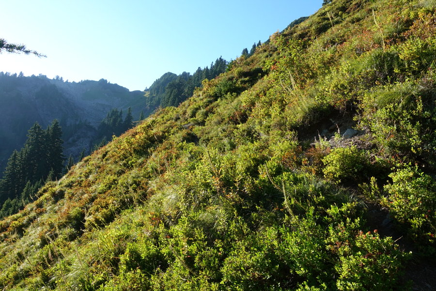
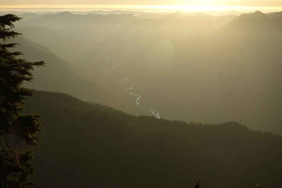
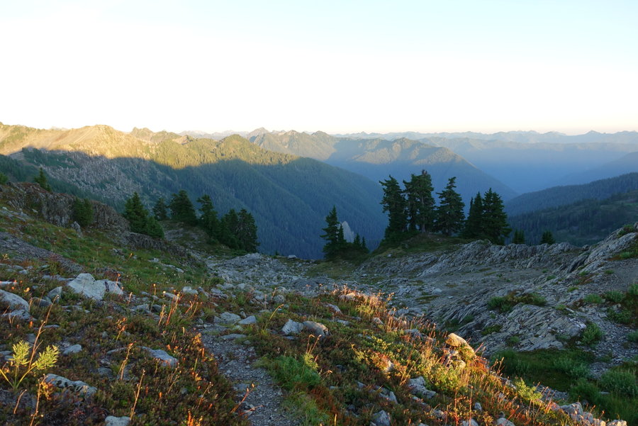
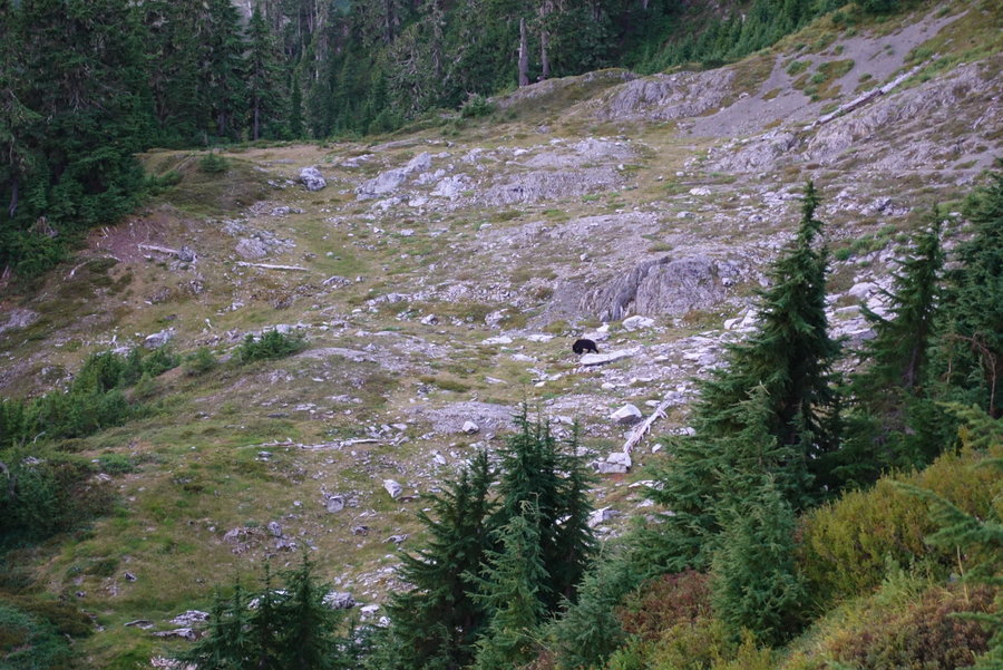
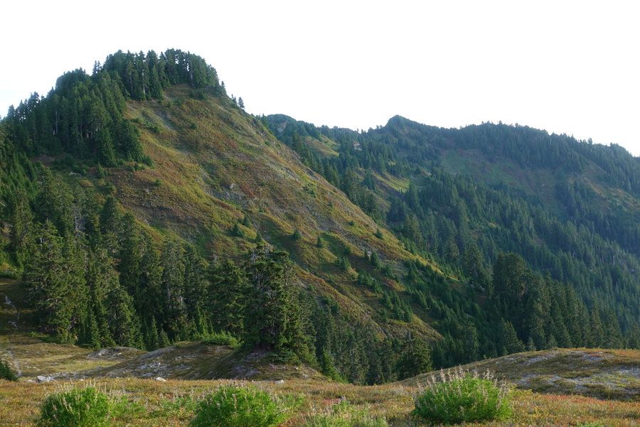
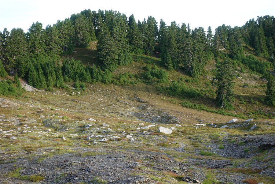
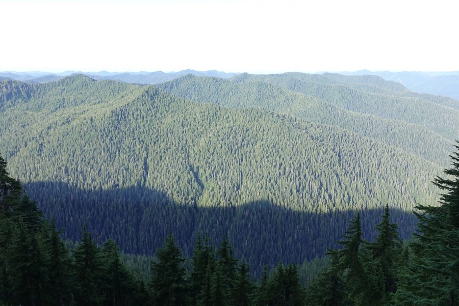
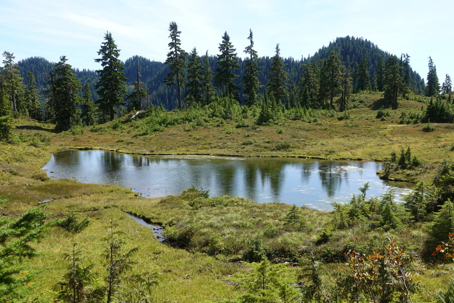
We knew we were in for a more difficult day since we were moving from maintained to primitive trail. It was an easy meadow stride over to the waterfall coming off of Mt. Seattle. The sun was already beating down on us, but we started our ascent in the trees. Trail was really overgrown, lots of narrow tread creeping downhill but I didn’t ever really feel unsafe. Huckleberries EVERYWHERE, and I started to make it a habit to make noise in case of bears. The views started to open up, and we spotted fog moving in through the valley. Eventually we were at an open meadow, and the trail eased to a more gentle stroll. Then came our descent, everything we had just gained was about to be lost. We started down and were startled by bear #1. We saw a furry butt scurry away from us as we had both surprised each other. We continued down the trail, and saw the full bear move away from us. We decided that we should stop for lunch in the shade, so part way into our descent we busted out some ramen. Once back on the trail, we ran into the only other hikers we would see for the day, a husband and wife working the loop in the opposite direction. We exchanged stories and talked about the difficulty of the route. It was Zane’s 40th birthday, and I joked that instead of presents I presented him with this difficult trip. The man told me he first hiked the skyline when he was 40. That left me with some confidence - if he was repeating the route it must be worthwhile. After our steep descent, it was time to rise up again. The most difficult part of this day was just the up down up down. There was one risky drainage crossing - scree and a huge drop with just a narrow line to hike. I managed and then we started on our next ascent. Overgrown, some annoying blowdown, but beautiful scenery. Eventually, we rounded a corner to a break in the mountains and an amazing view of Mount Olympus. While the trail skirted the edge of the ridge, the exposure was mostly okay though rugged. Once to our next descent to the Lake, the trail became a tangled mess of steep roots. It was brutal on our tired feet to head down steeply, but once we saw the scenery of the lake it was all worthwhile. Lake Beauty lived up to her name. We set up camp and ate dinner, watching a bear eat huckleberries in the meadow below. The next morning, we had a tiny visitor on the opposite side of the lake, getting a morning drink. I wish I could have spent an extra day here exploring. I didn’t see bear wire here, but we had eaten enough of our food to fit everything into the bear can.
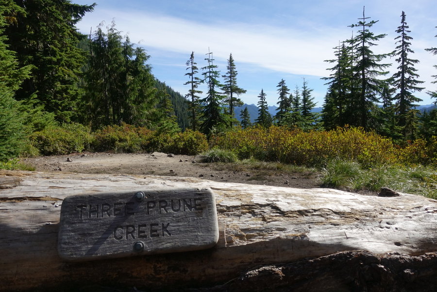
Day 4. Lake Beauty to… random spot along the way to Three Prune
This was by far our most difficult day. We set out intending to try to get as close to Three Prune as we could, so that our last day out would be less mileage. If I were to do this trip over, I would add an extra day and camp at Kimta Peak. The terrain between Lake Beauty and Kimta is tough, and warrants extra care. Besides that, the scenery is intense and beautiful, and worthy of extra time.
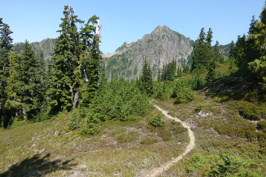
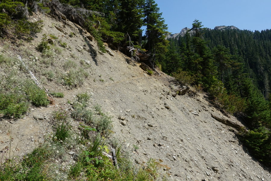
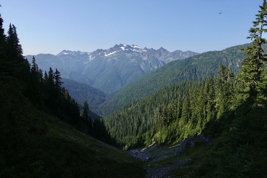
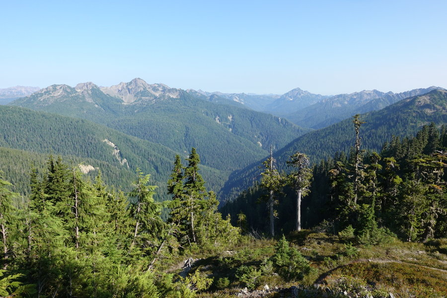
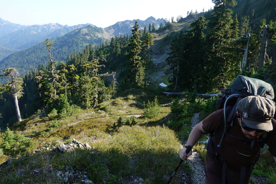
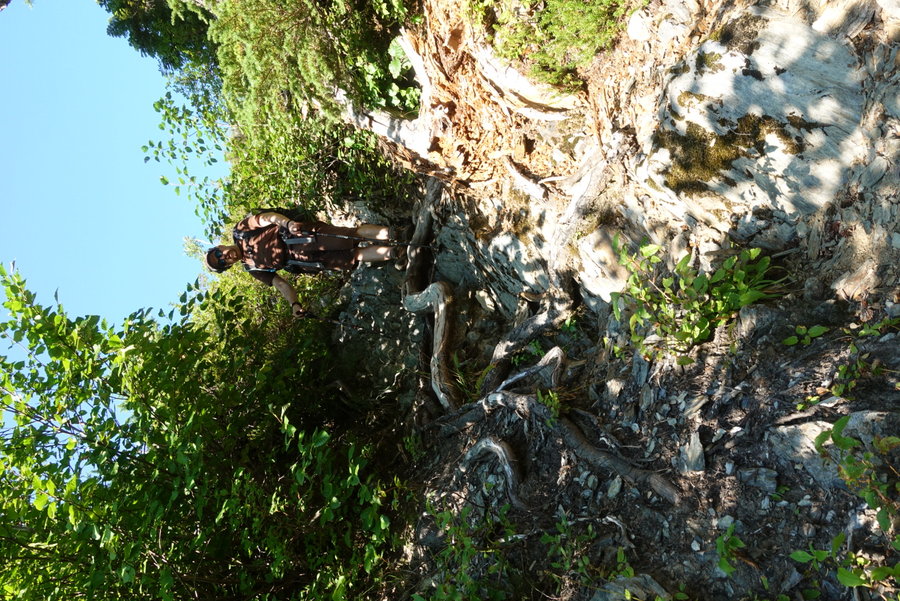
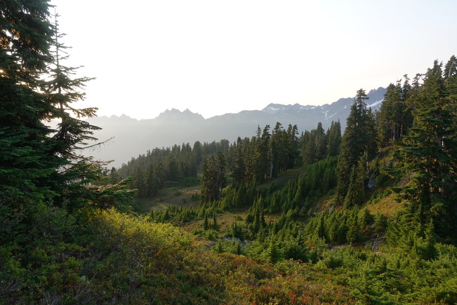
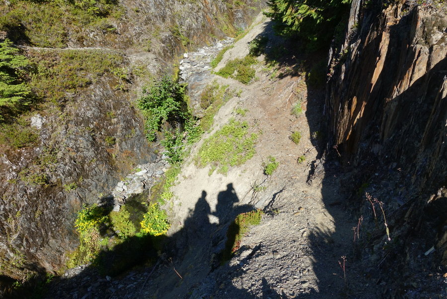
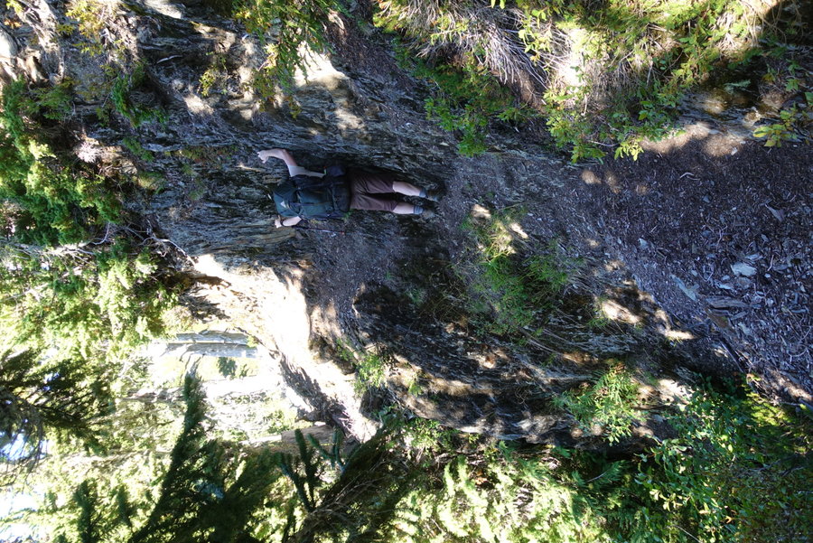
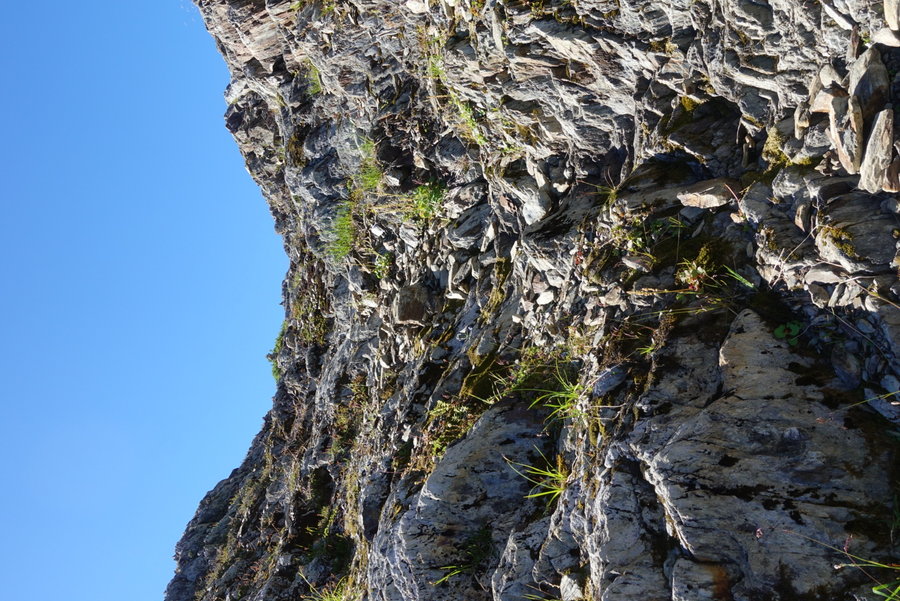
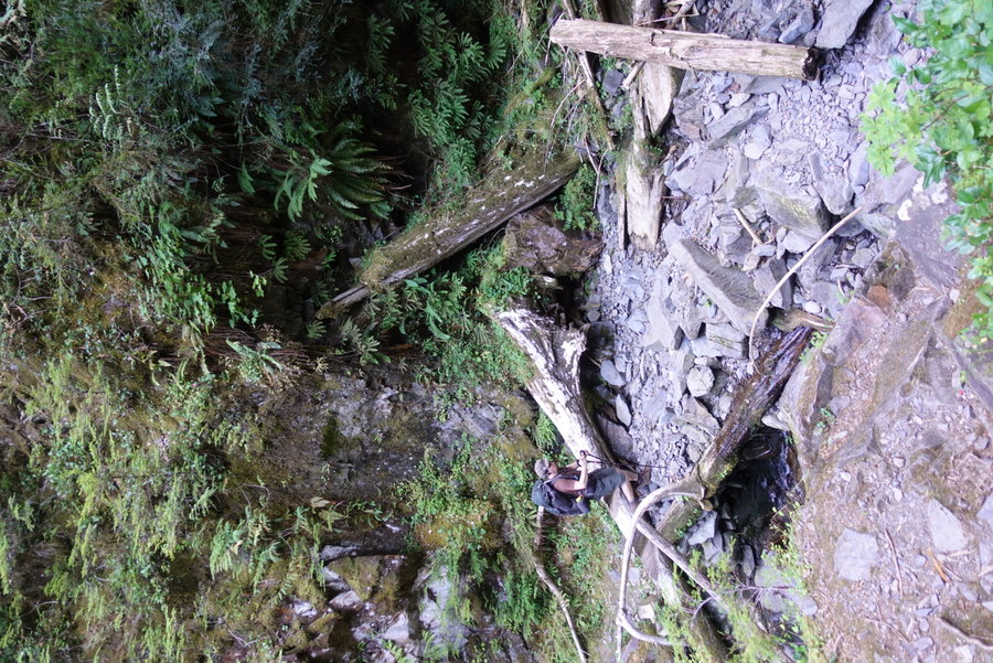
Lake Beauty to the Kimta burn saddle was challenging in the heat - blaring sun, exposure, and one really difficult exposed crossing. Every review I have read of this trail omits this glaringly awful spot on the trail, a real crux point where one could easily die. You round a corner - and suddenly - the trail disappears into the cliff. You are left with just a couple of spots to scramble on the cliff edge, and your hand holds are flaky rock. If we hadn’t already been past the point of no return on our loop, I may have turned around. The crossing is no problem without a pack, but with a pack you feel as if the cliff is pulling you downwards. I’ve had friends tell me that hiking is more hazardous than climbing, and this is a prime example. Zane knew I was in trouble, so he crossed with his own pack, and came back across to take mine. I went across with no weight, no problem, and then he stepped to make his way again with my pack. When he was almost across, he felt as if he was slipping and yelped for help that he was falling. I reached out for him but he was already pretty much across, just feeling the slight panic from the stress of the situation. I wouldn’t wish this upon anyone, and I do feel like this spot is a disaster in the making. Sadly, primitive trails in the park won’t ever see improvement, so I suspect eventually as the trail erodes more, it will become impassable without a reroute. EXTREME CAUTION needed here to pass.
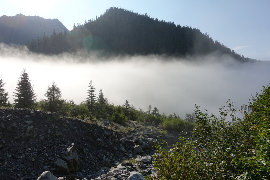
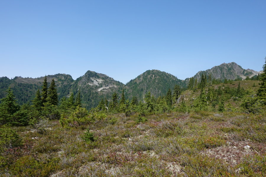
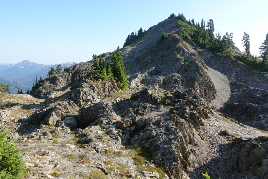
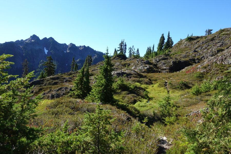
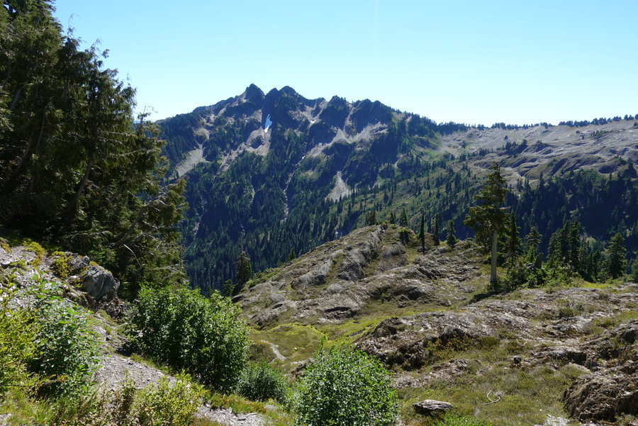
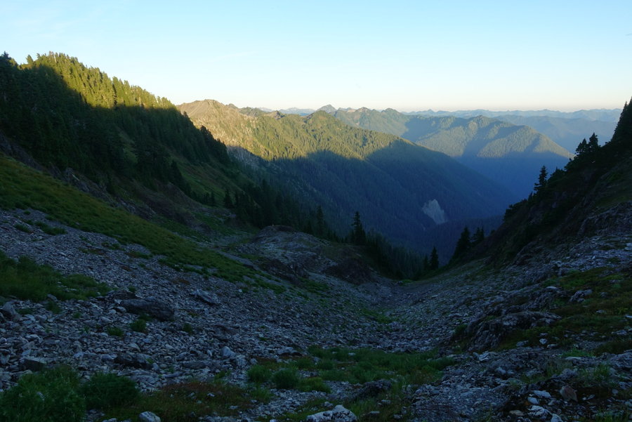
After the difficult crossing, you enter what is known as the moonscape, and quite possibly my favorite part of the trip. An incredibly weird landscape, non existent trail, but easy to follow if you trust the cairns. I imagine this area would be awful in fog/low visibility. After the stress of the cliff, I welcomed the fun scramble with incredible views. We did take an extended break for lunch in the little shade we could find, before our next steep descent. Right before our descent, we did spot an excellent but dry campsite in the few trees present on the ridge.
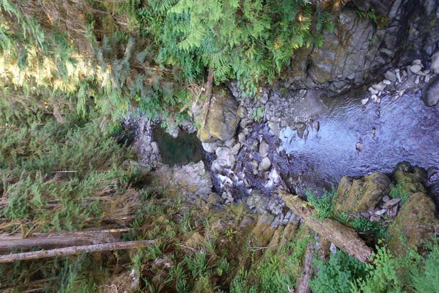
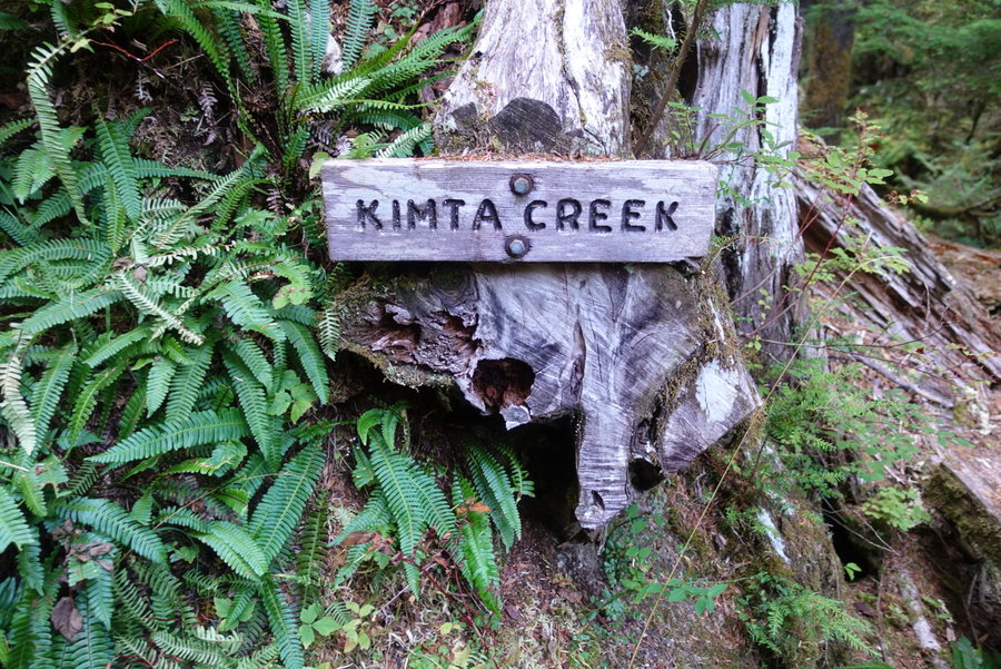
It was hard to go down, when we knew we would just be needing to go up again. The trail on the descent was good, and another bear was spotted. However, the Kimta burn to Kimta basin uphill struggle was awful. Trail was bad - barely there, cliff edges, blowdown, sun exposure, just awful. No way to get through this area fast, just shitty trail. Wouldn’t wish it upon anyone. We reached Kimta creek, and decided even though it was late, we would eat dinner and water up (last source of water, none between Kimta and Three Prune) We knew we couldn’t make it to Three Prune before we ran out of light, so we opted to get as far as we could. We passed many beautiful campsites, including two past Kimta that overlooked the Queets river. I wished that we could stay, but we knew the further we could get, the less mileage on our last day. Eventually, we ran out of daylight, and had to put on headlamps to try to find a suitable spot. I try to always LNT and use an established site, but we were in a pickle. Our last flat spot was a meadow, and beyond it was miles of descending on a steep cliff edge. We found a flat spot in the trees on the edge of a meadow and made camp for the night. The only bright side to this was the next morning - eating oatmeal (with huckleberries) we watched two bears across the meadow chowing down on berries oblivious to our presence.
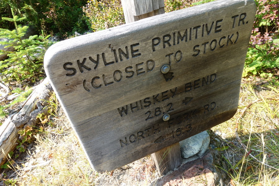
Day 5. Meadow to Ireley Lake Trailhead
Not making our mileage the previous day, we had a hard day ahead of us. Trail from Three Prune from the meadow wasn’t bad, some steep descent but trail was in good shape. We were happy to finally reach “maintained trail” and hoped for the best. Three prune was nice and we were kind of sad we didn’t get to camp there. I really don’t think it is wise to push yourself all the way to Three Prune from Lake Beauty. Do yourself a favor and camp at Kimta and enjoy the view. If I would have had an extra day I would have.
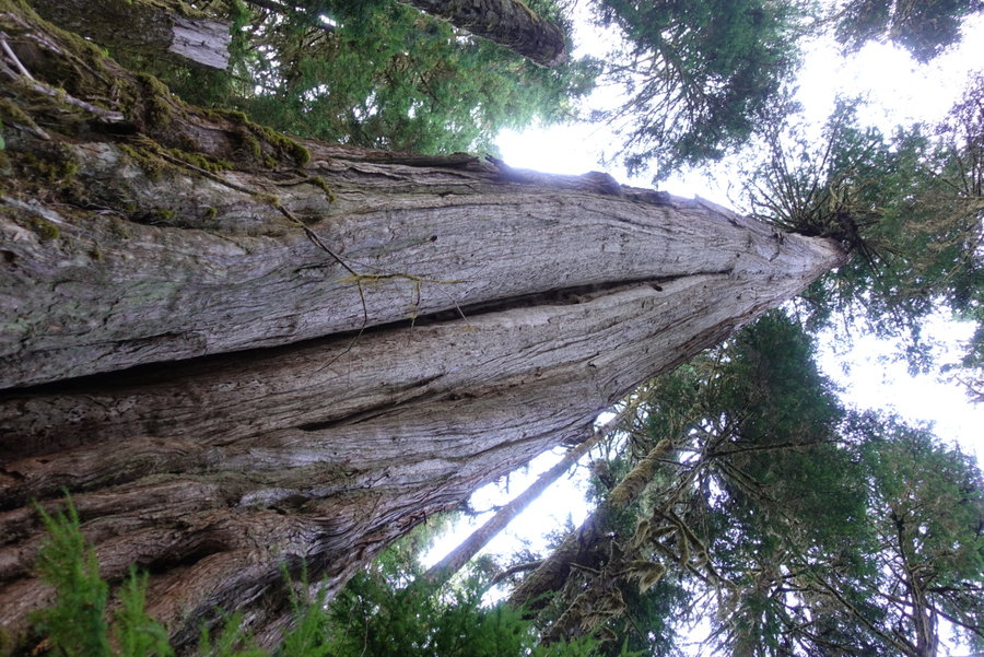
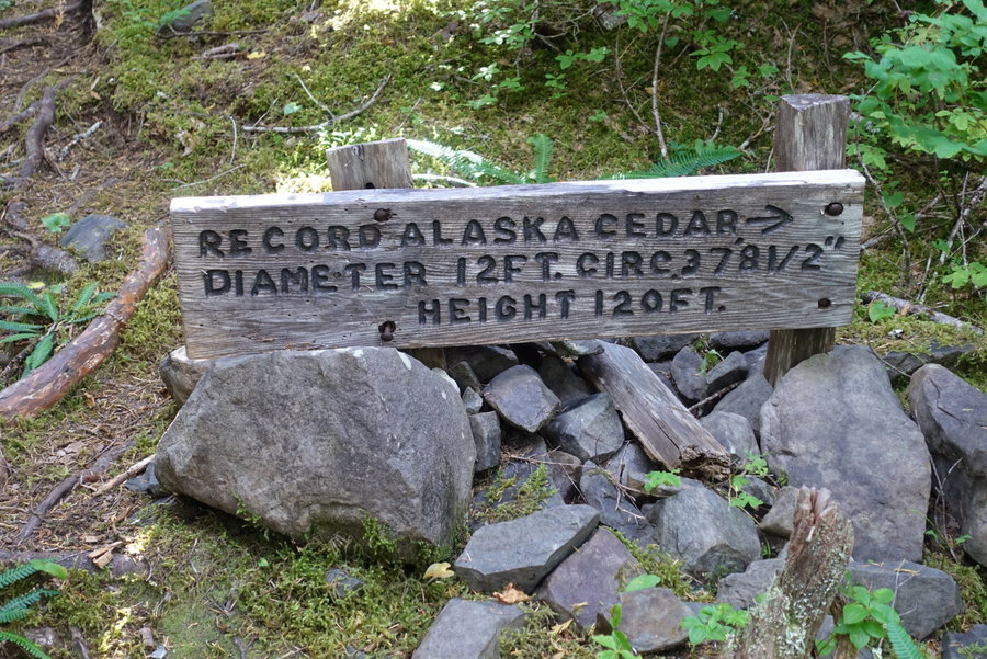
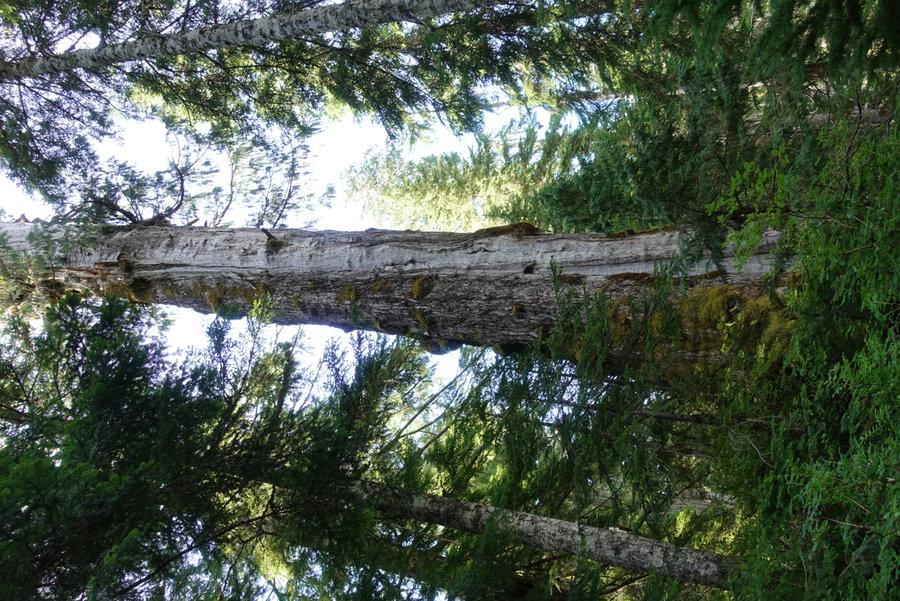
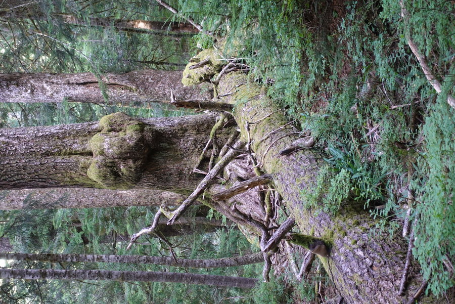
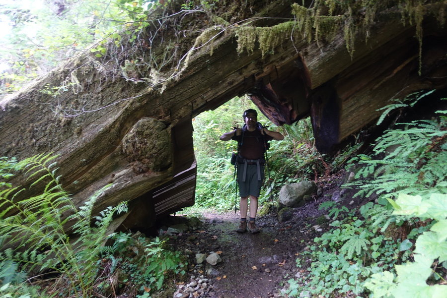
Trail was fine for the most part, but Zane and I had a lot of mileage to cover. We continued our descent. Beautiful old growth, and enormous Alaskan cedars to keep us entertained. We started seeing creatures and faces in the trees. I had visions of hamburgers awaiting me at the finish line. 1 mile to go, and the trail once again turned awful. Muddy, a stupid water crossing that should have a bridge .5 miles from the trailhead, blowdown, just annoying trail. This section made me incredibly crabby, when I just wanted to be done. I was happy when we finally reached the car.


Comments

Father Guido Sarducci
September 11, 2020
Wow! What an awesome trip. I have not explored that part of the ONP. Will have to check it out.

Sarah Johnson
September 12, 2020
Jen, reverse is definitely the way to go, if I were to do it again. The sun wouldn't be in your face for days. For us, the most difficult part was the heat/sun. Granted, I think temps were way above normal for the Olympics during this time. I would also do it in 5 or 6 nights, rather than 4 to really take the time to enjoy the high sections. So many side explorations, I would add Martin's Park as a side trip when at Low Divide. I just didn't have the time for it.
Jen
September 11, 2020
Mighty Fine! I considered this loop recently-in the reverse. Thanks for the beta.